I’ve spent years hopping on and off buses across European capitals, and Oslo stands out as one of the easiest cities to navigate without a car. Oslo uses a single, unified ticketing system called Ruter that covers all public transport including buses, trams, metros, local trains, and most ferries throughout the city. You can walk plenty in the compact city center, but you’ll want to use public transport to reach Oslo’s museums, parks, and neighborhoods on the outskirts.
The whole setup is pretty straightforward once you get the hang of it. Download the Ruter app on your phone, buy a ticket, and you’re set. Honestly? After dealing with chaotic bus systems elsewhere, Oslo feels refreshingly simple.
Key Takeaways
- Oslo’s entire public transport network runs on one ticketing system—buses, trams, metros, trains, and ferries
- The Ruter mobile app is the easiest way to buy and manage tickets
- Zone 1 covers all the main attractions and neighborhoods, so a single-zone ticket is enough for most visitors
Essential Overview: Best Ways to Get Around Oslo

Oslo’s public transport connects buses, trams, metro lines, local trains, and ferries under one ticketing system. That’s the most practical way to reach any part of the city. Walking works well in the compact center, and cycling’s become more popular with all the new bike lanes popping up.
Choosing the Most Efficient Transportation Methods
Public transport is honestly your best friend in Oslo. The Ruter system covers everything—buses, trams, the T-bane (metro), local trains, even some ferries. All these options run on the same ticket, which makes life so much easier.
The metro stands out because it gets you pretty much anywhere you’d want to go. Six lines branch out from downtown, reaching neighborhoods and even the hills. Trams run often through the center and work for short trips when walking feels like too much.
Buses fill the gaps where the trams and metro don’t go. They’re reliable, but rush hour traffic can slow things down. If you’re heading to the airport or the outer boroughs, local trains are the way to go.
Download the Ruter app before you arrive. It’s the simplest way to buy tickets and plan routes. Paper tickets cost more if you buy them on board, so the app saves you a bit too.
Biking’s really taken off, and you’ll spot dedicated lanes all over. Some parts are hilly, but with electric bike rentals, that’s not a big deal anymore.
Key Considerations for Visitors and Locals
Oslo uses a zone system for pricing, but here’s some good news: all of central Oslo is Zone 1. Unless you’re heading to the airport (which means a 4-zone ticket), you’ll probably stick to that one zone.
Ticket prices depend on how long you need them:
- Single tickets (60 minutes)
- 24-hour passes
- Weekly or monthly passes for longer stays
The Oslo Pass covers free public transport in zones 1-4N/4V and includes the Bygdøy ferries. If you’re planning to hit museums and attractions, it can save you a decent amount.
Peak hours (about 7-9am and 3-6pm weekdays) get crowded. If you can, travel outside those times for a comfier ride.
One thing I didn’t expect—tickets are transferable. If you’ve got a day pass you’re done with, you can hand it off to someone else.
Areas Best Explored Without a Car

The historic center around Karl Johans gate is super walkable. You can stroll from the Royal Palace to Oslo Central Station in maybe 15 minutes. Most attractions, restaurants, and shops are packed into this area.
Driving in central Oslo? Honestly, not worth it. The city discourages it with tolls, limited parking, and environmental zones. Parking’s expensive, and many streets block cars anyway.
Aker Brygge and Tjuvholmen along the waterfront are made for pedestrians—walking beats everything else here. Same deal in Grünerløkka, a trendy neighborhood with cafes and vintage shops on narrow streets.
Vigeland Park and the Bygdøy museum district are easy to reach by public transport and nice for walking once you’re there. Ferries to Bygdøy leave from the harbor and offer a pretty cool view along the way.
To reach the Oslo fjord islands or forests, combine public transport with walking. The system gets you close enough that a car just isn’t necessary.
Public Transport System in Oslo: Ruter and Vy
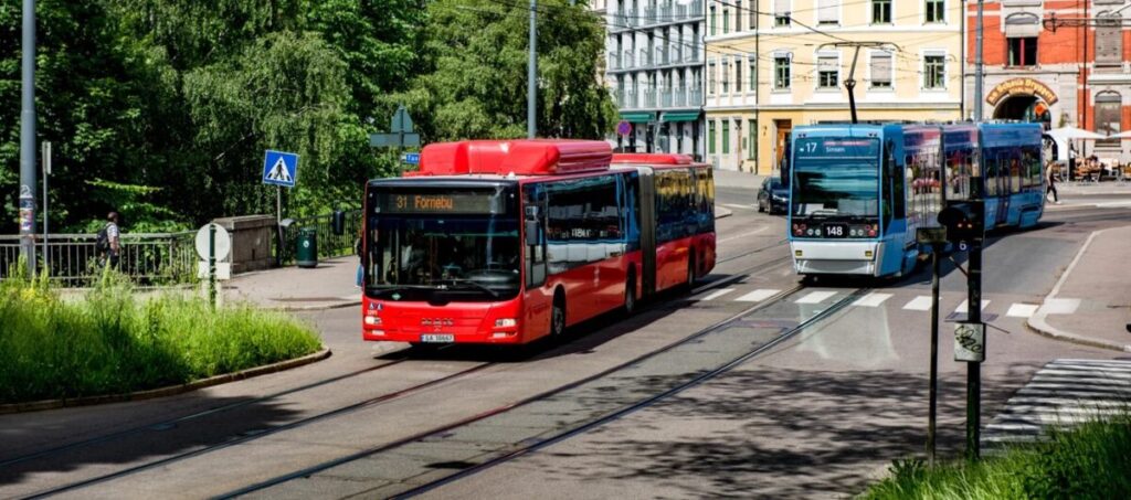
Two main operators run Oslo’s public transport: Ruter handles city transport (metro, trams, buses, ferries), and Vy runs regional trains to areas outside Oslo.
Understanding Ruter and Vy Services
Ruter is your main operator for getting around Oslo. They run the T-bane, trams, city buses, and ferries. One ticket covers all these, so you don’t have to think too hard about it.
The metro has six lines that branch out from the city center, making it easy to reach different neighborhoods and attractions. Trams mostly stick to the center and work for short hops. Buses go everywhere else the metro and trams don’t.
Vy is different. They run regional and long-distance trains. If you want to visit somewhere outside the main city zones, you’ll probably end up on a Vy train. The ticket systems aren’t the same, so your Ruter ticket only works on Vy trains in some overlapping zones.
Some train stations serve both Ruter and Vy, so double-check which service you need before buying a ticket—it’s easy to mix them up.
How Zones and Transfers Work
Oslo uses a zone-based fare system. Zone 1 covers most of central Oslo—where you’ll spend your time if you’re visiting or catching a bus to another city.
A single Ruter ticket costs 44 NOK and lasts for 60 minutes. During that hour, you can switch between buses, trams, metro, and ferries as much as you need, as long as you stay within your ticket’s zones. Honestly, this is one of the best parts of the system.
If you go to outer zones, it costs more. Zone 1+2 tickets are pricier than just Zone 1. Most tourists stick to Zone 1, but if you’re heading out to the airport or suburbs, you’ll need to pay for more zones.
Day tickets (132 NOK) and multi-day passes can save you money if you’re traveling a lot. You can buy tickets at station machines, convenience stores, or on the app.
Ruter App and Real-Time Updates

Definitely grab the Ruter app before you start exploring. You can buy and store tickets right on your phone—no more waiting in line at machines.
The app shows real-time arrivals and departures for buses, trams, and metro lines. Super helpful, since it tells you exactly when the next bus is coming, not just the scheduled time. Norwegian public transport’s usually on time, but hey, things happen.
You can also try Entur, another journey planner that covers all of Norway’s public transport, including Ruter and Vy. Some folks like Entur better because it gives more route options and works well for regional trips.
Both apps let you plan routes, check delays, and see how crowded certain departures are. The Ruter app works in English, and buying tickets is easy—just activate your ticket right before you board.
Tickets and Passes: What You Need to Know
Oslo’s public transport uses a zone-based fare system managed by Ruter. You’ll need either single tickets or a pass to ride buses, trams, the metro, and ferries. The Oslo Pass bundles transport with museum entries, while regular Ruter tickets just cover travel.
Types of Tickets and Validity
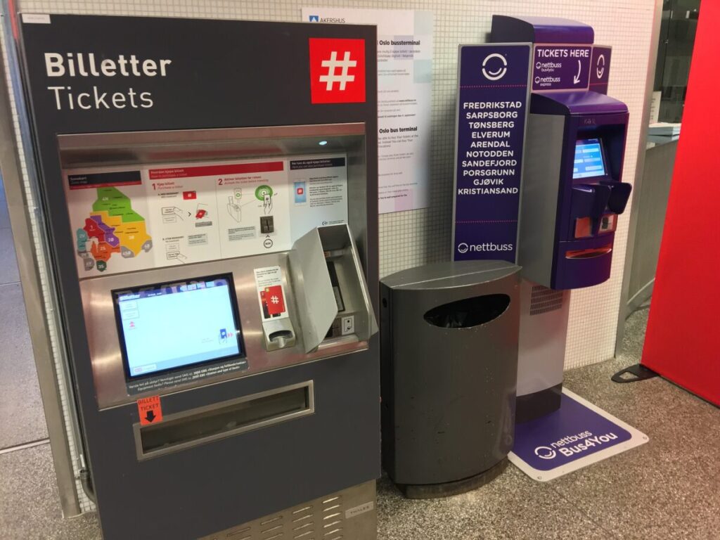
Ruter tickets come in a few types depending on how long you’re staying and how much you’ll travel. Single tickets last one hour in zones 1 and 2, which covers central Oslo and most tourist spots. You can also grab 24-hour or 7-day tickets for more trips.
The zone system’s pretty simple. Zone 1 is the city center, and most attractions are within zones 1-2. If you’re heading to places like Lillestrøm or further, just add extra zones to your ticket.
Kids under 6 ride free. Ages 6-17 and seniors over 67 pay less. Keep in mind, your ticket’s countdown starts the moment you activate it—not when you buy it.
Buying and Using Ruter Tickets
The easiest way to get Ruter tickets is the Ruter app. Download it, set up an account, add a payment method, and you’re good to go. It’s way faster than messing with ticket machines, and you get real-time departure info too.
You can also buy tickets at the red Ruter machines in metro stations, big tram stops, and some bus terminals. These take cards and cash. Some convenience stores with a blue Ruter sign sell them as well.
Heads up: you can’t buy tickets from bus drivers anymore. You need a valid ticket before boarding. Inspectors check often, and fines for riding without a ticket are steep—around 1,150 NOK. Not worth the risk.
Oslo Pass: Benefits and How to Get It

The Oslo Pass gives you unlimited public transport in zones 1-4 plus free entry to over 30 museums and attractions. It costs 550 NOK for 24 hours, 800 NOK for 48 hours, or 945 NOK for 72 hours.
The pass covers all buses, trams, metro lines, ferries, and local trains. Airport trains to Gardermoen are included, but not the Flytoget express. If you’re planning to visit museums like the Munch Museum or Holmenkollen, the pass pays for itself pretty quickly.
You can buy the Oslo Pass online and either use it digitally or pick up a physical card at the Oslo Visitor Centre next to Central Station. The pass activates the first time you use it, so jot down when that happens.
The pass isn’t tied to one person technically, but only one person can use it at a time. And yes, you can visit attractions on different days if you have a multi-day pass.
Metro, Trams, and Buses: Exploring Oslo’s Core
Oslo\’s public transport backbone is the T-bane metro system with five lines reaching deep into neighborhoods, trams weaving through the city center and eastern districts, and a big bus network connecting over 50 routes across the capital. All three use the same ticketing system managed by Ruter, so transfers are seamless.
Oslo Metro (T-bane): Coverage and Top Destinations

The T-bane is probably your best friend for getting around Oslo quickly. Five main lines fan out from the city center in different directions, all passing through a shared tunnel downtown with stops at Jernbanetorget (right by Oslo S train station), Stortinget, and Nationaltheatret.
Lines 4 and 5 head west toward the forests and ski areas. If you’re staying in the center, you’ll likely use these to reach Holmenkollen or the trails around Frognerseteren. Lines 1, 2, and 3 go eastward and northward, serving neighborhoods like Grünerløkka (though you might prefer the tram there), Tøyen, and Grorud.
What’s nice about the metro is that it runs mostly above ground once you leave downtown. You get some real views of the city and the hills, which beats staring at tunnel walls. Trains show up every 10-15 minutes during the day on weekdays, and a bit less often on weekends.
The metro covers all of zone 1, which includes pretty much anywhere you’d want to go as a visitor. From Jernbanetorget, you can reach the Vigeland Park area in about 20 minutes, or head to the forests in 30.
Trams (Trikk): Scenic and Convenient Travel
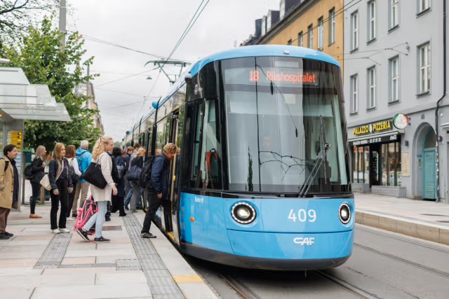
Oslo’s trikk system is smaller than in some European cities, but it’s perfect for certain routes. Six tram lines run mainly in the city center and eastern neighborhoods, gliding along street level so you can watch the city pass by.
Lines 11, 12, and 13 are the ones you’ll use most. They connect the central station area with popular spots like Aker Brygge, Majorstuen, and the trendy Grünerløkka district. Line 12 is especially handy since it forms a ring around the eastern part of downtown.
The trams are slower than the metro—no question about it. But they’re more pleasant for shorter trips when you’re not in a rush. You board at street-level stops marked with blue signs, and you’ll need to have your ticket ready before you get on since there’s no way to buy one onboard.
Trams get crowded during rush hour (roughly 7-9 AM and 3-5 PM). If you’re traveling with luggage or just prefer personal space, try to avoid these times.
Buses: Reaching the Suburbs and Special Routes

The buss network in Oslo is massive—over 50 routes crisscross the city and surrounding areas. While tourists often stick to the metro and trams, buses fill in the gaps and take you places the rail systems don’t reach.
Some buses leave from the Oslo bus terminal (Oslo Bussterminal) near Galleri Oslo shopping center, but plenty of routes have stops scattered throughout downtown. Route numbers in the 30s typically serve the city center, while higher numbers head to suburbs and neighboring municipalities.
Night buses (routes starting with “N”) run after the metro and trams stop, usually until around 4 AM on weekends. These follow modified versions of the main daytime routes and are honestly a lifesaver if you’re out late.
You can buy tickets directly from the bus driver, but it costs more than using the Ruter app. The driver will give you a look if you try to pay with large bills, too. One quirk: some buses connect to local trains at transfer points, letting you extend your reach beyond Oslo proper with the same ticket (as long as you stay in the right zones).
Accessibility and Night Services
All newer metro trains and trams have low-floor sections and designated wheelchair spaces. Older tram models are being phased out, but you might still run into a few with steps. Buses generally work for wheelchairs, with ramps available if you ask the driver.
The metro runs until about 12:30 AM on weekdays and all night on Friday and Saturday nights. Night buses take over when the metro stops, following similar routes but with fewer stops.
Station elevators sometimes break down—it happens more than it should. Jernbanetorget and other major stops have multiple elevator options, but smaller metro stations might leave you stuck if the one elevator is out of service. The Ruter app doesn’t always update this info in real-time, which is frustrating.
Real-time departure boards at stops work well most of the time. You can also track your bus or tram in the Ruter app to see exactly where it is and when it’ll arrive.
Alternative Transportation: Biking, Ferries, and Car Options
Oslo offers several ways to get around beyond traditional buses and trains. You can pedal through the city on shared bikes, hop on ferries to explore the fjord islands, or rent a car for trips outside the city center.
Cycling and Oslo City Bike Guide

Biking in Oslo is honestly one of the best ways to see the city, especially during the warmer months. The city has invested heavily in bike lanes and paths that connect most neighborhoods and attractions.
Oslo City Bike (also called Oslo Bysykkel) is the official bike-sharing program. You’ll find 244 stations scattered throughout the city, making it super convenient to grab a bike and go. The system operates 24 hours a day during the season, which typically runs from April through November.
To use Oslo Bysykkel, download the app and create an account. You can choose from different subscription options—either a single day pass or longer-term plans if you’re staying a while. Each trip lets you ride for up to 60 minutes before you need to dock the bike at another station.
The bikes themselves are sturdy and built for city riding. They’re not the fastest or lightest, but they get the job done. Just grab one from any station, unlock it through the app, and you’re off. Pro tip: during rush hour, some stations fill up quickly, so you might need to walk to the next one to find an available dock.
Getting Around by Ferries and the Oslofjord

The ferry system (or “ferge” in Norwegian) is part of Oslo’s regular public transport network operated by Ruter. These aren’t tourist boats—they’re how locals actually get to the islands dotting the Oslofjord.
Your regular Ruter ticket works on all ferries, which is a nice perk. The boats leave from Aker Brygge and Vippetangen, heading to islands like Hovedøya, Gressholmen, and Langøyene. In summer, ferries run frequently from early morning until late evening. Winter schedules shrink to just a few departures daily.
The ferry ride itself is part of the experience. You get views of the Oslo Opera House, the new neighborhoods along the waterfront, and the forested islands as you approach them. Many locals use the ferries to reach beaches and hiking spots during weekends.
Car Rentals, Car Sharing, and Driving in Oslo

Driving in Oslo isn’t something most visitors need to do. The city actively discourages car use through tolls, limited parking, and car-free zones in the center.
But if you’re planning day trips to places like Bergen or want to explore the Norwegian countryside, having a car makes sense. Traditional rental companies operate at the airport and in the city, though prices can be steep.
Hyre is a popular car-sharing app that lets you rent vehicles by the hour or day. There’s no membership fee—you only pay when you actually use a car. It’s worth downloading if you just need wheels for a few hours to haul luggage or make a quick trip outside town.
Oslo uses an automatic toll system called AutoPASS. If you’re in a rental car, the tolls get charged directly to your rental agreement. The city has multiple toll rings, and fees vary by time of day and vehicle type.
Taxi and Ride-Sharing Services
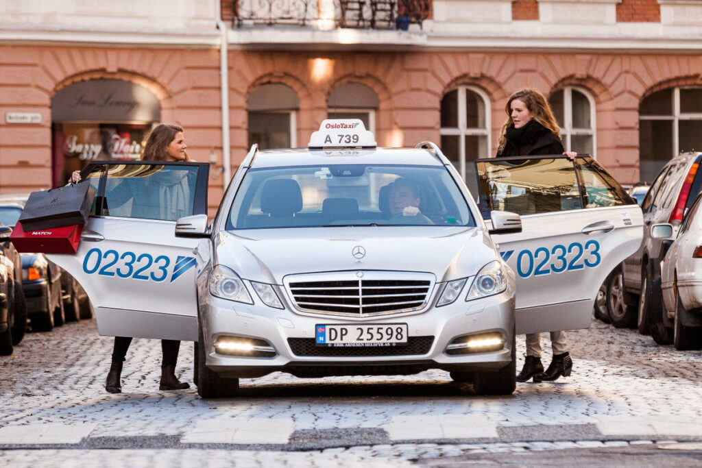
Taxis in Oslo are reliable but expensive—probably the priciest option for getting around. Oslo Taxi is the largest company, and you’ll see their cars throughout the city.
Both Uber and Bolt operate here, which gives you more options and price transparency. I’d recommend checking both apps before booking since prices fluctuate. Sometimes Bolt is cheaper, other times Uber comes out ahead.
Taxis can be hailed on the street or found at designated taxi stands near major train stations and hotels. But honestly, most people just use the apps now because you know exactly what you’ll pay before the ride starts.
Late at night or early morning, ride-sharing becomes more useful since public transport runs less frequently. Just be prepared for surge pricing during peak times like weekend nights or when there’s bad weather.
Airport Transfers and Travel Beyond the City
Oslo Airport Gardermoen sits about 50 kilometers northeast of downtown, and getting between the two is straightforward with trains, buses, and taxis all making regular runs. Your choice of transport depends on your budget and how quickly you need to reach the city, and the same rail network that connects the airport also opens up day trips to towns and fjords throughout the region.
How to Get from Oslo Airport Gardermoen to the City

You’ve got several solid options when you land at Oslo Airport Gardermoen. The Flytoget express train is the fastest choice, whisking you to the city center in about 20 minutes for around 240 NOK. It’s quick and reliable, but you’re paying a premium for that speed.
Here’s where most travelers miss a trick: the regular Vy trains cover the same route for 114-129 NOK and only take about 5-10 minutes longer. That’s a significant saving if you’re not in a massive rush. Both trains leave from the same airport station and stop at Oslo S (Oslo Central Station) and other downtown points like Nationaltheatret.
Airport buses run by Flybussen and similar companies offer another alternative at around 180-200 NOK. They take 40-50 minutes depending on traffic, which can be unpredictable during rush hours. I’ve used them when I had extra luggage and wanted door-to-door convenience to certain hotels.
Taxis will set you back considerably more—expect 700-900 NOK for the journey. They make sense if you’re traveling in a group or arriving late at night when you just want to get to bed without thinking about train schedules.
Regional Trains, Vy, and Entur for Wider Exploration
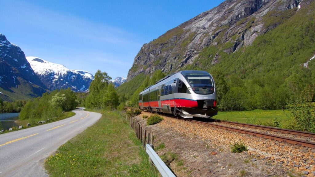
Vy operates Norway’s national rail network, and those same trains from the airport can take you well beyond Oslo’s boundaries. The system connects you to Bergen, Trondheim, Stavanger, and countless smaller towns worth exploring on day trips.
Entur is the app you’ll want to download before you even leave the airport. It’s the official journey planner for all public transport in Norway, not just Oslo. You can book tickets, check real-time departures, and compare routes across trains, buses, and even ferries.
Regional trains from Oslo reach places like Drammen (40 minutes), Lillehammer (2 hours), and Fredrikstad (1 hour) for reasonable fares. Book ahead through Entur or Vy’s website for the best prices—last-minute walk-up fares can sting quite a bit. Weekend trips to fjord towns become genuinely doable when you understand how the rail network spreads out from Oslo.
Connection Points: Oslo S and Oslo Central Station
Oslo S and Oslo Central Station are the same place—just different names for the city’s main railway hub. Every train from the airport stops here, making it your primary connection point for onward travel.
The station sits right in the city center near Karl Johans gate and connects to the metro, trams, and local buses. If you’re heading to a specific neighborhood, you might want to stay on the airport train one more stop to Nationaltheatret or continue to Skøyen, depending on where your accommodation is located.
Long-distance trains to other Norwegian cities leave from Oslo S, as do regional services heading south and west. The station can feel a bit chaotic during peak hours, but signage is clear in both Norwegian and English. There’s luggage storage if you want to explore the city before an evening departure.
Top Attractions and Neighborhoods: Getting There with Ease
Oslo’s main attractions spread across different neighborhoods, but the city’s public transport system connects you to nearly everything worth seeing. You’ll find trams, buses, and metro lines running frequently to cultural landmarks, waterfront districts, and green spaces throughout the city.
Reaching Major Landmarks by Public Transport

The Oslo Opera House sits right by the central station, so it’s one of the easiest landmarks to reach. You can walk there in about 10 minutes from Oslo S, or just hop on tram 12 or 13 straight to Operahuset stop. That white marble building really does look like it’s rising out of the fjord, and you can wander right up onto the sloping roof—kind of surreal if you ask me.
Aker Brygge, the waterfront area packed with restaurants and shops, is about a 15-minute stroll from the city center. If your feet are tired, bus 54 or tram 12 will get you there. The harbor promenade dishes up great views of the Oslo Fjord and links to other waterfront spots.
For the Munch Museum‘s newer location at Bjørvika, you can take bus 60 or walk about 20 minutes from central Oslo. The museum opened in 2021 near the Opera House, so it makes sense to visit both at once. Tram 13 also stops nearby at Operahuset.
Neighborhoods to Explore: Grünerløkka, Bygdøy Peninsula, and Nordstrand

Grünerløkka is Oslo’s hip, artsy neighborhood packed with vintage shops, cafes, and street art. Trams 11, 12, and 13 all run through here, or you can take the metro to Birkelunden or Grünerløkka stations. The area’s pretty compact, so once you arrive, everything’s walkable. Locals hang out along Akerselva river, which winds right through the neighborhood.
The Bygdøy Peninsula holds several of Oslo’s best museums, like the Viking Ship Museum and the Fram Museum. Bus 30 from the city center gets you there in about 15 minutes. During summer (usually May through September), ferry boats run from Aker Brygge pier to Bygdøy—a scenic 10-minute ride that’s included in your Oslo Pass but costs extra if you don’t have one.
Nordstrand is a quieter residential area south of the center with nice beaches along the fjord. Metro line 3 or 4 will get you there, though honestly, most tourists skip this neighborhood unless they’re staying nearby or want to escape the crowds.
Parks and Cultural Spots: Vigeland Park, Frogner Park, Munch Museum

Vigeland Park (officially part of Frogner Park) shows off over 200 bronze and granite sculptures by Gustav Vigeland. It’s Oslo’s most visited attraction, and tram 12 drops you right at the entrance at Vigelandsparken stop. You could also take bus 20 or metro line 2 to Majorstuen, then walk about 10 minutes.
The sculptures show human figures in all sorts of poses—some beautiful, some strange, all interesting. The famous Monolith tower in the center took three stone carvers 14 years to finish.
Frogner Park is actually the larger green space with Vigeland Park inside it. The same tram and bus lines serve both. In summer, locals picnic and play frisbee on the lawns. There’s a public pool here too if you’re visiting in warm weather.
The Munch Museum takes a bit more planning since it’s not right in the city center. Bus 60 is your best bet, or just walk if the weather’s decent. The museum holds thousands of Edvard Munch’s works, including several versions of “The Scream.”
Practical Tips for Navigating Oslo
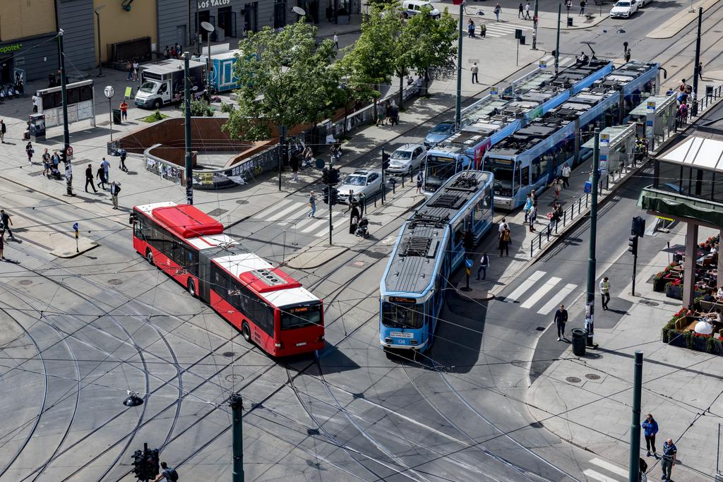
Oslo’s public transport system runs smoothly once you know which apps to download, what locals expect, and what to expect in terms of safety and cleanliness standards.
Useful Apps and Planning Tools
The Ruter app is your must-have download before you step onto any bus, tram, or metro in Oslo. Use it to buy tickets, check real-time departures, and plan routes across the whole network. It accepts mobile payments and keeps your tickets on your phone, so you don’t have to deal with paper slips at bus stops.
Entur is another solid option that covers not just Oslo but all of Norway. It’s handy for trips that mix city buses with regional trains or when you need connections outside the Ruter network.
For getting around on two wheels, Oslo City Bikes runs a bike-share system with stations all over the central areas. Download their app, buy a subscription, and unlock bikes right from your phone. They’re perfect for quick trips between neighborhoods.
Visit Oslo’s official app bundles transport info with museum listings and events, which is nice when you’re planning a full day out. Google Maps works well with Oslo’s transit too, but honestly, locals seem to prefer the Ruter app for accurate info during rush hour.
Travel Etiquette and Accessibility
Norwegians really value personal space and quiet on public transport. Keep your phone calls short and use headphones for music or videos. Most people just sit quietly or read—loud behavior stands out fast.
Move to the back of the bus or tram after boarding so others can get on. And yes, you should give up your seat for elderly folks, pregnant women, or anyone with mobility challenges. People expect it here.
The whole public transport system has made big investments in accessibility. Low-floor trams and buses mean wheelchairs roll on easily, and metro stations usually have elevators. Audio announcements call out each station, and visual displays show upcoming stops for folks with hearing impairments.
Safety, Cleanliness, and Night Travel Advice
Oslo’s buses and trains are impressively clean compared to a lot of European cities. They get cleaned regularly, and you rarely see the kind of mess you might find elsewhere. Passengers don’t typically eat messy foods onboard.
Safety isn’t much of a concern, even late at night. I’ve taken night buses through all sorts of neighborhoods without any trouble, and you’ll spot solo travelers of all ages doing the same. Security cameras watch most vehicles, and drivers keep an eye on the passenger areas.
Night buses run on weekends along major routes, marked with an “N” in front of the route number. They operate after the metro shuts down around 12:30 AM on weekdays (a bit later on weekends). The crowd is a mix of shift workers and people heading home from nights out, but things usually stay calm and pretty orderly.
Frequently Asked Questions
Oslo’s public transport system works well, but visitors often have specific questions about tickets, maps, and getting around without a car.
What are the best public transportation options for navigating Oslo?
The Ruter network covers all public transport in Oslo and lets you use metros, trams, buses, and local trains with one ticket. The metro system is especially handy since it connects most of the city and runs frequently.
Trams are great for shorter trips in the city center. Buses fill in the gaps and reach neighborhoods the trains and trams don’t cover.
For trips to the Oslofjord islands or Bygdøy peninsula, ferries run regularly in summer. Just remember, ferries to Bygdøy aren’t included in regular Ruter tickets unless you have an Oslo Pass.
Is there a comprehensive map of the Oslo metro system available?
The Ruter app gives you the whole metro map plus real-time arrival info. Download it free and use it offline once you’ve loaded the maps.
You’ll find paper maps at Oslo Visitor Centre and at major metro stations. The metro’s pretty straightforward with just a handful of lines, so you don’t need to study it for hours.
Zone 1 covers all of Oslo proper, including the final stops on each metro line. This makes trip planning easier since most tourist spots are in this single zone.
Where can tourists purchase tickets for Oslo’s public transportation?
The Ruter mobile app is the easiest way to buy and manage tickets. You can get single rides, day passes, or longer tickets right from your phone.
If you prefer paper tickets, go to the Oslo Visitor Centre, Ruter’s customer service center, or any Narvesen or 7-Eleven. Just know that weekly, monthly, or annual tickets need a reusable plastic travel pass, which costs 50 NOK extra.
The Oslo Pass gives you unlimited travel in zones 1, 2, 3, 4V, and 4N, and it covers those Bygdøy ferries. It also gets you into museums and attractions for free or at a discount.
Are ride-sharing services like Uber available in Oslo?
Yes, Uber runs in Oslo alongside regular taxis. It works the same as elsewhere—just open the app and request a ride.
Regular taxis are easy to find too, though they’re pricier than public transport. You can hail them on the street, find them at taxi stands near major hotels and train stations, or call ahead to book one.
If you’re on a budget, stick with public transport since taxis and ride-sharing add up fast in Norway.
How can visitors travel around Oslo if they choose not to rent a car?
You really don’t need a car in Oslo. The public transport network covers pretty much everywhere you’d want to see, and most attractions cluster in walkable neighborhoods.
Honestly, walking is one of the best ways to experience the city center. Distances are short, and you’ll notice little details or stumble into cafes and shops you might otherwise miss.
Oslo’s bike-share program gives you another easy, car-free option. The city set up dedicated bike lanes on many streets, so cycling feels safer and a bit more relaxed than in a lot of other European capitals.
Between the metro, trams, buses, and your own two feet, you can get just about anywhere. Plus, you’ll dodge the headache of parking and save some cash on rental fees.